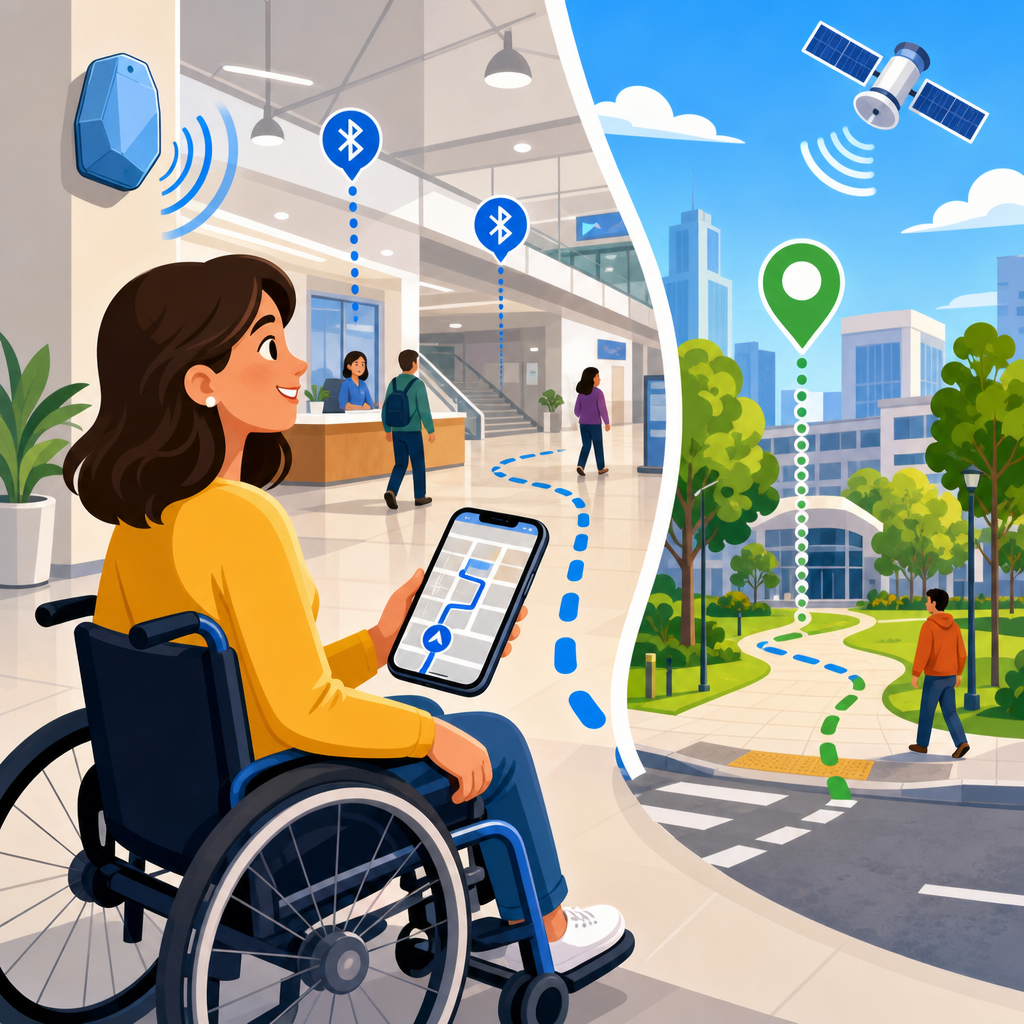
Accessible wayfinding with BLE, GPS, and indoor navigation is reshaping how people move through cities, campuses, airports, hospitals, transit hubs, and public buildings by turning location data into usable guidance for everyone, including people with disabilities. Wayfinding means helping someone understand where they are, where they need to go, and how to follow a safe, efficient route. In accessibility work, that simple definition expands quickly: guidance must account for stairs, curb ramps, elevator outages, temporary barriers, lighting conditions, crowded corridors, audio clarity, cognitive load, and the difference between being technically reachable and genuinely navigable.
BLE, or Bluetooth Low Energy, supports proximity-based positioning indoors through battery-powered beacons and compatible smartphones. GPS, the best-known satellite positioning system, works well outdoors but usually degrades inside buildings, underground stations, and dense urban canyons. Indoor navigation fills that gap by combining BLE with Wi-Fi positioning, inertial sensors, digital maps, computer vision, QR or NFC checkpoints, and routing engines that understand accessibility attributes. In practice, strong accessible wayfinding systems rarely depend on one sensor alone. They use sensor fusion, calibrated maps, and well-maintained points of interest to provide instructions that are timely, specific, and relevant to the user’s needs.
This matters because navigation is a legal, operational, and human issue at the same time. Under the Americans with Disabilities Act, Section 508, EN 301 549, and the Web Content Accessibility Guidelines, organizations increasingly need digital experiences that are usable by people with visual, mobility, hearing, and cognitive disabilities. I have worked on venue maps and navigation deployments where the technology performed well in demos but failed in live use because elevator metadata was stale, beacon batteries were unmanaged, or turn-by-turn instructions ignored how screen reader users process spoken directions. Emerging technologies solve real problems only when they are implemented with accessible design, maintenance discipline, and governance. As a hub topic, accessible wayfinding connects law, procurement, mapping, mobile UX, smart buildings, and assistive technology into one practical framework.
How BLE, GPS, and Indoor Navigation Work Together
The core principle is straightforward: GPS answers the outdoor location problem, while BLE and indoor positioning methods answer the indoor one. A mobile app or navigation service reads satellite signals outside, then transitions to indoor signals near entrances or once GPS confidence drops. BLE beacons broadcast identifiers that a phone can detect and translate into proximity or position estimates. Indoor navigation platforms then match that estimate to a building map, determine the user’s destination, and generate accessible instructions such as “enter through the west doors, continue twenty feet, elevator bank on your right.”
In real deployments, seamless handoff is the hard part. Hospitals are a useful example because they combine parking lots, sidewalks, multiple entrances, elevators, clinics, and temporary detours. If the transition from outdoor to indoor positioning is abrupt or inaccurate, the user loses trust immediately. The best systems use geofences, entrance markers, and confidence scoring to detect when to switch positioning modes. They also identify landmarks that matter to disabled travelers: tactile warning strips, reception desks, accessible restrooms, hearing loop locations, and automatic door operators. Navigation quality depends less on flashy interface design than on whether those environmental details are captured and maintained.
Accuracy expectations should also be realistic. GPS accuracy outdoors commonly ranges from roughly 5 to 10 meters on consumer devices, though newer dual-frequency phones can do better in open sky. BLE often supports room-level or sub-room guidance when beacon density, placement, calibration, and smartphone behavior are all managed carefully, but signal reflections, human bodies, metal structures, and changing interiors can reduce precision. That is why robust accessible wayfinding typically pairs BLE with inertial measurement units, map matching, and clear user confirmations instead of pretending the blue dot is always exact.
Designing Navigation for Different Accessibility Needs
Accessible wayfinding is not one feature. It is a set of route choices, interface patterns, and content decisions tailored to different users. Blind and low-vision users often need concise audio prompts, heading orientation, landmark-based confirmation, and reliable rerouting. Wheelchair users may prioritize step-free routes, door widths, elevator dimensions, slope, and surface quality. Deaf and hard-of-hearing users may need strong visual cues, captioned alerts, vibration feedback, and information about assistive listening systems. Neurodivergent users may benefit from simplified directions, reduced sensory overload, and predictable route structure.
In projects I have seen succeed, teams stop treating accessibility as a generic toggle. They create route profiles and environmental metadata that map directly to user needs. For example, an accessible route in a university science building may exclude stairs but still fail a power wheelchair user if it includes heavy manual doors or steep connectors. A “shortest route” in an airport may be worse than a “least complex route” for someone with cognitive fatigue. Good systems let users set preferences while preserving transparency about tradeoffs, such as a longer but quieter route or a shorter route that depends on one elevator.
Instruction writing is equally important. Turn-by-turn guidance should avoid ambiguity like “go over there” or “take the next left” when multiple branches are nearby. Better prompts name landmarks and orientation cues: “With the reception desk ahead, turn left and follow the wall for thirty feet.” For screen reader users, timing matters. Prompts delivered too early are forgotten; prompts delivered too late create stress. Teams should test instructions while walking the route with VoiceOver, TalkBack, switch control, haptic alerts, and low-bandwidth conditions, not just in design review sessions.
Core Technologies and Their Strengths, Limits, and Use Cases
No single location technology dominates every accessible navigation scenario. The best choice depends on building complexity, budget, maintenance capacity, privacy requirements, and desired precision. BLE remains popular because beacons are relatively inexpensive and easy to deploy. GPS remains essential for outdoor routing. Wi-Fi positioning can reduce hardware needs in buildings with strong access point coverage. Ultra-wideband offers high precision but higher infrastructure and device constraints. Computer vision can enrich navigation with object recognition and signage reading, but it raises processing, battery, and privacy considerations.
| Technology | Best Use | Typical Strength | Main Limitation |
|---|---|---|---|
| GPS/GNSS | Outdoor routing and approach to entrances | Wide coverage without local hardware | Weak indoors and near tall structures |
| BLE Beacons | Indoor proximity and waypoint guidance | Low-cost deployment and smartphone support | Requires battery management and calibration |
| Wi-Fi Positioning | Indoor location in managed networks | Uses existing infrastructure | Precision varies with access point density |
| Inertial Sensors | Dead reckoning between anchors | Works without constant signal updates | Drift accumulates over time |
| Computer Vision | Sign, door, and landmark recognition | Rich contextual feedback | Lighting and privacy constraints |
These technologies are strongest when combined. A transit station, for instance, may use GPS outside, BLE along concourses, inertial sensors through crowded zones, and QR codes at key decision points. Vendors such as Esri Indoors, HERE, Situm, NextBillion.ai, and Google Maps Platform support parts of this stack, but procurement should focus on interoperability, exportable map data, accessibility attributes, and maintenance tooling rather than brand promises. If a platform cannot represent accessible entrances, temporary closures, or alternate vertical circulation, it is not mature enough for serious deployment.
Emerging technologies are also shifting the field. Digital twins now help facilities teams connect indoor maps with building operations. Real-time occupancy feeds can identify congested paths. Computer vision and AI can classify signage or detect blocked routes, though these capabilities still need human verification. The practical takeaway is clear: accessible navigation improves when location technology is treated as infrastructure, not as an isolated mobile feature.
Data, Mapping, and Standards That Make Wayfinding Trustworthy
The invisible foundation of accessible wayfinding is structured spatial data. Every route instruction depends on map geometry, points of interest, vertical connections, accessibility attributes, and update workflows. If a building map lacks elevator status, automatic door locations, or restroom accessibility details, the routing engine cannot infer them later. Teams need a canonical indoor map model with version control, ownership, and audit trails. In operational terms, that means facilities, IT, digital product, and accessibility stakeholders all share responsibility for data quality.
Several standards and specifications matter. GeoJSON is common for geospatial data exchange. Indoor mapping may rely on IndoorGML, IMDF from Apple, IFC and BIM-derived datasets for building information, or custom schemas extended with accessibility attributes. On the web and in apps, WCAG 2.2 informs interface accessibility, while ARIA patterns affect how route steps, alerts, and map alternatives are exposed to assistive technology. For public entities and vendors, Section 508 and EN 301 549 shape procurement expectations. The legal requirement may focus on digital accessibility, but navigation accuracy and route transparency are what establish real trust.
Trust also depends on lifecycle management. Beacon identifiers must match map waypoints. Batteries need replacement schedules. Temporary construction barriers must flow into the routing engine quickly. I have seen one convention center achieve strong results by assigning map stewardship to operations staff who already owned room scheduling and event layouts. Because they updated floor changes daily, navigation remained credible. Another site treated maps as a one-time project artifact; within months, routes were sending users to locked corridors. The lesson is simple: accessible wayfinding is a living service, and stale data is its fastest failure mode.
Privacy, Security, and Legal Risk in Location-Aware Accessibility
Location data is sensitive because it can reveal routines, medical visits, religious attendance, workplace patterns, and mobility limitations. Accessible wayfinding systems should collect only what is necessary, explain why it is needed, and define retention clearly. GDPR, CCPA, state privacy laws, and sector-specific obligations may apply depending on jurisdiction and venue type. For hospitals, clinics, and universities, internal governance often matters as much as external regulation because navigation logs can become operationally revealing even when they are not directly regulated health records.
Security controls should include encrypted communications where appropriate, strict API authentication, role-based access to map and analytics tools, and separation between personally identifiable information and aggregate traffic analysis. BLE beacons themselves usually broadcast simple identifiers, but the backend that interprets those identifiers can still become a target. Threat models should consider spoofed beacons, rogue apps, inaccurate route injection, and denial of service against map services. If a system is used for emergency egress or after-hours access, resilience requirements rise sharply.
Legal exposure does not come only from privacy incidents. There is also risk in marketing a route as accessible when it is not. If an app directs a wheelchair user to an out-of-service lift without warning, the issue is not merely poor usability; it may implicate disability rights obligations, safety policies, and procurement representations. Organizations should publish limitation statements, monitor route failures, and define escalation paths for corrections. Precision in language matters here. Promise dependable assistance, not flawless positioning.
Implementation Roadmap for Emerging Technologies in This Hub Topic
As the hub page for emerging technologies within legal and technological frontiers, this topic should guide readers from concept to deployment. Start with use cases, not hardware. Determine whether the primary need is patient navigation, accessible campus routing, museum guidance, workplace inclusion, or multimodal transit support. Then inventory spatial data, accessibility features, and operational constraints. Pilot in one building or path network, establish success metrics such as route completion rate and user confidence, and expand only after resolving data gaps and maintenance workflows.
Procurement should require accessible native apps or web experiences, map export rights, standards-based APIs, screen reader compatibility, low-vision support, privacy documentation, and a service-level plan for data updates. Testing must include disabled users in realistic conditions: background noise, crowded corridors, weak connectivity, detours, and device battery limitations. Measure not only positional accuracy but also comprehension, stress, recovery from errors, and the usefulness of alternate routes.
The strongest accessible wayfinding programs combine BLE, GPS, and indoor navigation into one managed ecosystem built on trustworthy data, legal awareness, and continuous feedback. That is why this emerging technologies hub matters: it connects accessibility law, geospatial engineering, mobile product design, and smart-building operations into actionable practice. If you are building or buying navigation tools, begin by auditing your map data, route logic, and accessibility assumptions, then test them with the people who will rely on them most.
Frequently Asked Questions
What does accessible wayfinding mean in practice, and how do BLE, GPS, and indoor navigation work together?
Accessible wayfinding is the process of helping people understand where they are, where they need to go, and how to travel there safely and confidently, with guidance that works for a wide range of abilities and environments. In practice, that means much more than showing a dot on a map. An accessible wayfinding system should account for curb ramps, elevator access, stair avoidance, door widths, tactile landmarks, audible cues, lighting conditions, path obstructions, and the specific needs of people who are blind or low vision, Deaf or hard of hearing, have mobility disabilities, cognitive disabilities, or temporary impairments. The goal is not simply navigation, but usable navigation.
Each technology contributes a different layer. GPS is highly effective outdoors and helps establish a person’s position across streets, campuses, city blocks, parking areas, and transit connections. Bluetooth Low Energy, or BLE, is often used indoors through strategically placed beacons that allow smartphones or assistive apps to estimate proximity and location where GPS becomes unreliable. Indoor navigation systems then add map intelligence, routing logic, and environmental data, such as which entrance is accessible, which elevator serves a destination floor, or which corridor is currently closed. When these systems are integrated well, users can move from sidewalk to entrance to lobby to elevator to office suite with a more continuous experience.
The most effective accessible wayfinding platforms also combine location technologies with real-time instructions in multiple formats. That can include turn-by-turn audio, high-contrast visual prompts, haptic feedback, simplified step sequences, landmark-based instructions, and route options tailored to accessibility preferences. For example, one person may want the shortest route, while another may need a step-free route with automatic doors and minimal slope. The real value of BLE, GPS, and indoor positioning is that they transform raw location signals into guidance people can actually use in complex public spaces.
Why is GPS alone not enough for accessible navigation in airports, hospitals, campuses, and other complex public spaces?
GPS is essential for outdoor navigation, but it has important limits that become especially problematic in accessibility-focused wayfinding. Satellite signals often weaken or drift near tall buildings, under canopies, inside transit stations, and within large indoor facilities. Even when GPS appears accurate enough for general consumer use, it may not be precise enough for critical accessibility decisions, such as identifying the correct building entrance, locating a curb ramp instead of a staircase, distinguishing between parallel pathways, or guiding someone to the correct side of a hospital reception desk.
Complex public environments introduce many navigation challenges that GPS was never designed to solve on its own. Airports contain multiple floors, checkpoints, gates, concourses, elevators, and service areas. Hospitals include towers, clinics, departments, wings, and elevators with restricted access. University campuses may have similarly named buildings, uneven terrain, open plazas, and indoor-outdoor transitions. In all of these places, people need much more than a broad estimate of location. They need route guidance that understands entrances, floor levels, obstacles, and accessible alternatives.
For accessible wayfinding, precision and context matter as much as basic position. Someone using a wheelchair may need confirmation that the entrance ahead has a ramp and automatic door. A blind traveler may need cues about whether they are approaching a lobby desk, an elevator bank, or a staircase landing. A person with a cognitive disability may benefit from clearer segmented instructions tied to visible landmarks. Indoor navigation systems supported by BLE beacons, detailed digital maps, and facility data fill these gaps by providing room-level or corridor-level guidance. That is why GPS is best understood as one part of a broader location ecosystem, not a complete accessibility solution by itself.
How do BLE beacons improve indoor accessibility and navigation for people with disabilities?
BLE beacons improve indoor accessibility by helping mobile devices determine location and proximity in places where GPS signals are inconsistent or unavailable. These small, low-power transmitters are typically installed throughout buildings such as airports, museums, hospitals, office towers, transit hubs, and educational campuses. A smartphone app can detect signals from nearby beacons and use them, often in combination with mapping and sensor data, to estimate where a person is standing or moving. That location awareness allows the system to deliver context-specific guidance inside buildings.
From an accessibility perspective, BLE is valuable because it supports more precise and timely instructions. Instead of generic directions like “go to the second floor,” a beacon-enabled system can provide more actionable guidance such as “the elevator is 20 feet ahead on your right” or “you have reached the accessible entrance to the clinic.” For users who are blind or low vision, this can significantly reduce uncertainty in unfamiliar environments. For wheelchair users, it can help identify routes that avoid stairs, narrow passages, steep grades, or inaccessible restrooms. For people with cognitive disabilities, BLE-supported navigation can break complex journeys into manageable, location-aware steps.
BLE also supports more inclusive design when paired with accessible app features. Instructions can be delivered through screen readers, voice guidance, vibration, large text, high contrast, or simplified interface modes. In some implementations, beacons can trigger orientation information automatically when users enter a space, reducing the need to search manually. However, beacon hardware alone does not guarantee accessibility. Success depends on thoughtful placement, accurate mapping, ongoing maintenance, and route content that reflects real-world accessibility conditions. In other words, BLE becomes truly useful when it is part of a carefully designed navigation experience built around user needs rather than just infrastructure deployment.
What makes an indoor navigation system truly accessible instead of just technically functional?
A technically functional indoor navigation system can locate users and generate routes, but a truly accessible one is designed around how different people perceive, process, and move through space. Accessibility requires the system to support multiple input and output methods, provide route options based on real user needs, and communicate environmental details that affect safety and independence. That includes compatibility with screen readers, keyboard navigation, voice interaction, high-contrast visual design, scalable text, clear language, haptic feedback, and step-by-step directions that are understandable even in stressful or crowded settings.
Equally important is the quality of the route data. An accessible system should know whether a path includes stairs, whether an elevator is available, whether a door is automatic or heavy manual, whether a restroom is accessible, whether a corridor is temporarily blocked, and whether an entrance is usable from public transit drop-off points. It should also support preference-based routing. Some users may want to avoid stairs; others may prioritize the fewest turns, quietest path, best lighting, widest corridors, or easiest check-in point. Accessible wayfinding is strongest when users can personalize guidance instead of being forced into a one-size-fits-all route.
Testing is another major differentiator. Systems built without direct feedback from disabled users often miss practical barriers that look minor on a map but create real problems in use. A route may be technically possible yet confusing, exhausting, or unsafe. Truly accessible indoor navigation is developed and validated with people who have lived experience across disability groups. It also includes governance: updates when building layouts change, auditing for accuracy, monitoring beacon health, and maintaining accessibility metadata over time. In short, accessibility is not a feature layered on top of navigation. It is a design standard that shapes the maps, the interface, the routing logic, and the entire user experience.
What should organizations consider when implementing accessible wayfinding across public buildings and large facilities?
Organizations should begin by treating accessible wayfinding as part of core access infrastructure, not a convenience feature. The first step is understanding the environment in detail: entrances, elevators, stairs, ramps, reception points, security checkpoints, restrooms, service counters, waiting areas, emergency exits, and any temporary or recurring obstacles. Those physical features need to be translated into reliable digital maps with accessibility attributes that routing systems can use. Without accurate underlying data, even the best app interface or positioning technology will produce inconsistent guidance.
Technology selection should follow the use case. GPS may cover outdoor circulation and campus navigation, while BLE beacons, Wi-Fi positioning, or other indoor location methods may be needed for interior spaces. Many organizations benefit from a hybrid model that supports continuous navigation from parking or transit arrival through the final indoor destination. They should also prioritize interoperability with smartphones, assistive technologies, and existing visitor systems. If the navigation tool only works for a narrow set of devices or fails with screen readers, adoption will suffer quickly.
Implementation should also include direct participation from disabled users, facilities teams, digital accessibility specialists, and operations staff. That collaboration helps uncover issues that are easy to miss, such as confusing terminology, inaccessible entry sequences, unreliable elevator access, or instructions that do not match how people actually orient themselves. Ongoing maintenance is critical as well. Buildings change constantly due to renovations, closures, event setups, security procedures, and equipment outages. Accessible wayfinding must be updated to reflect those realities in near real time whenever possible. Finally, organizations should think about trust. Users will rely on this guidance in environments that may be stressful or unfamiliar, so accuracy, consistency, privacy protections, and transparent communication are essential to long-term success.


