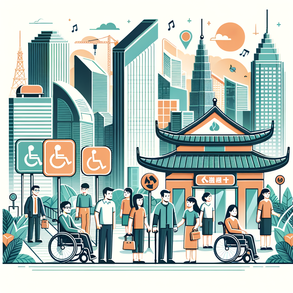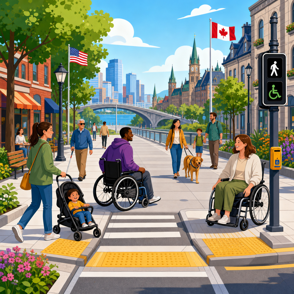
Accessible public right-of-way design determines whether streets, sidewalks, crossings, transit stops, and shared civic spaces can be used safely and independently by everyone. In practice, the term public right-of-way covers pedestrian routes within public streets and adjacent corridors, including curb ramps, detectable warnings, pedestrian signals, refuge islands, boarding areas, and the many small transitions that either preserve access or create barriers. After working on accessibility reviews for municipal streetscape projects, I have seen how minor dimensional decisions, such as cross slope at a driveway or pushbutton reach range at a signal pole, can decide whether a route works for a wheelchair user, an older adult with limited balance, or a blind traveler using a cane.
A cross-border perspective matters because no single country has solved every challenge. Different regulatory systems, climates, urban forms, and funding structures have produced distinct solutions that others can adapt. The United States has detailed proposed standards for rights-of-way through the Public Rights-of-Way Accessibility Guidelines, while Canada often integrates accessibility through provincial standards and complete streets policies. The United Kingdom has refined tactile paving guidance and inclusive mobility practice. Scandinavian cities have paired winter maintenance discipline with universal design principles. Japan has normalized tactile guidance and rail-station access at a scale few countries match. Learning across borders helps agencies avoid reinventing standards, understand tradeoffs, and prioritize interventions that deliver measurable improvements in safety, dignity, and independent mobility.
This hub article explains the most important international innovations and strategies in accessibility for public rights-of-way. It defines the core design elements, compares how different countries approach them, and highlights the policy and maintenance practices that make design details succeed in the real world. It also serves as a roadmap for deeper study: tactile walking surface indicators, curb ramp geometry, signalized crossings, bus stop access, shared streets, temporary traffic control, and digital auditing all sit within one connected accessibility system. For transportation departments, planners, designers, advocates, and facility managers, the main lesson is straightforward: the best accessible streets are not created by isolated features, but by continuous, predictable, and maintainable networks shaped by international evidence.
What Accessible Public Right-of-Way Design Includes
Accessible public right-of-way design is the planning, engineering, construction, and maintenance of pedestrian infrastructure so that people with mobility, sensory, cognitive, and age-related disabilities can travel independently. The core principle is continuity. An accessible sidewalk segment is not enough if it ends at a missing curb ramp, a crossing without audible information, a bus stop with no boarding pad, or a utility pole placed in the clear width. Designers often talk about the pedestrian access route as a connected system, and that systems view is the starting point for every successful international program.
Across countries, the same functional components appear repeatedly. Clear width allows passing and maneuvering. Running slope and cross slope affect wheelchair propulsion and drainage. Surface firmness, stability, and slip resistance matter for canes, walkers, and prosthetic users. Vertical changes, gaps, and joints influence trip risk and wheel entrapment. At intersections, curb ramps, blended transitions, tactile warnings, pedestrian timing, median refuge, and channelization determine whether crossing is legible and safe. Near transit, boarding and alighting areas, shelter placement, wayfinding, and platform interfaces become critical. These are technical subjects, but their purpose is simple: reduce uncertainty and unnecessary physical effort.
One useful international lesson is that accessibility standards work best when they are performance oriented as well as dimensional. A ramp can meet a slope criterion on paper yet fail because ponding forms at the gutter, snow blocks the landing, or the flare intrudes into the walking path. Countries that combine precise design guidance with inspection, maintenance, and user testing achieve better outcomes. That is why accessibility audits increasingly include field measurements, route tracing, and direct participation by disabled people rather than relying only on plan review.
Regulatory Frameworks and National Approaches
The United States has influenced global practice through disability rights law and technical guidance. The Americans with Disabilities Act established the legal obligation for equal access, and the U.S. Access Board’s work on rights-of-way has given agencies a detailed framework for pedestrian routes, curb ramps, detectable warnings, and on-street parking. State departments of transportation and large cities often supplement federal guidance with standard drawings and transition plans. The strength of the U.S. model is enforceability through civil rights mechanisms; the weakness is uneven implementation across thousands of local jurisdictions with different budgets and legacy conditions.
Canada offers a more decentralized but increasingly rigorous model. Provinces such as Ontario have established accessibility standards under the Accessibility for Ontarians with Disabilities Act, while cities like Toronto and Vancouver have embedded accessibility in complete streets guidance, transit stop design, and procurement requirements. A notable Canadian lesson is the integration of accessibility with winter operations. Snow clearing response times, storage practices, and attention to curb ramps are treated as access issues, not merely maintenance preferences. In northern climates, that framing is essential.
The United Kingdom has long shaped international practice through Inclusive Mobility guidance, Local Transport Notes, and especially nationally recognized tactile paving patterns. The UK approach places heavy emphasis on predictability and standardized tactile meanings, such as blister paving at controlled crossings and corduroy warnings at hazards like steps. This level of consistency helps blind and low-vision pedestrians interpret spaces without relearning signals from one district to another. The tradeoff is that highly codified tactile systems require disciplined installation and staff training; inconsistent use can undermine the very predictability they are meant to create.
Japan demonstrates what network-scale accessibility looks like when rail, streets, and wayfinding are aligned. Tactile guidance paths are widespread in stations and sidewalks, elevators are commonly integrated into major transit nodes, and barrier-free policies have steadily pushed local improvements. Japanese cities also show that dense environments can still support legible accessible routes when curb lines, platform edges, and pedestrian circulation are carefully managed. Meanwhile, Nordic countries contribute a strong universal design culture and practical expertise in snow, ice, lighting, and pedestrian priority. Their lesson is that climate resilience and accessibility are inseparable.
Design Innovations That Travel Well Across Borders
Some accessibility strategies transfer well between countries because they solve universal movement problems. Raised crossings, for example, reduce grade changes, calm traffic, and improve route continuity when designed with clear drainage and detectable edge definition. Pedestrian refuge islands improve crossing safety on wide streets, but international best practice shows they must be sized for wheelchairs, mobility scooters, and people with guide dogs, not just painted as narrow medians. Accessible pedestrian signals with audible and vibrotactile indications have become increasingly standardized because they directly address the information gap at signalized crossings.
Another widely transferable innovation is the use of tactile walking surface indicators with distinct meanings. Countries differ on pattern details, but the principle is clear: warning and guidance surfaces should communicate specific information through texture and, where possible, visual contrast. In my project reviews, the most common failure is not absence but misuse—guidance strips leading into furniture zones, warning surfaces installed too far from the hazard, or products chosen for color without considering slip resistance. International examples consistently show that tactile systems succeed only when tied to route logic.
Digital tools are also changing practice. Mobile data collection platforms such as ArcGIS Field Maps, Fulcrum, and customized asset management systems let agencies inventory curb ramps, cross slopes, obstructions, and signal equipment at scale. Some cities are combining LiDAR, imagery, and computer vision to identify barriers more efficiently, though field verification remains necessary. The most mature programs use these tools not merely to map noncompliance, but to prioritize fixes by risk, route importance, and linkage to schools, hospitals, transit, and civic destinations.
| Country or region | Notable strategy | Why it matters |
|---|---|---|
| United States | Detailed rights-of-way standards and transition planning | Creates enforceable technical benchmarks for streets and crossings |
| United Kingdom | Standardized tactile paving vocabulary | Improves predictability for blind and low-vision pedestrians |
| Japan | Networked tactile guidance and station accessibility | Connects streets and transit into a coherent travel chain |
| Nordic countries | Winter maintenance integrated with universal design | Preserves access during snow, ice, and low-light conditions |
| Canada | Accessibility embedded in complete streets and operations | Links design standards with maintenance and local delivery |
Common Failure Points and How Leading Cities Address Them
The biggest barriers in public rights-of-way are usually ordinary details repeated thousands of times. Driveway crossings often create excessive cross slope that pulls wheelchairs sideways and destabilizes walkers. Utility cabinets, sign posts, café seating, and micromobility parking narrow the clear route. Poor drainage leaves standing water at curb ramps. Temporary traffic control during construction removes accessible paths without providing equivalent alternatives. These problems appear in cities worldwide because they sit at the boundary between design intent and day-to-day street management.
Leading cities address these failures through standardization, permitting controls, and inspection. London boroughs and several Australian councils have published detailed street furniture placement rules to protect pedestrian clear zones. U.S. cities with strong accessibility programs increasingly review construction staging for pedestrian access just as rigorously as vehicle detours. Stockholm, Oslo, and Helsinki emphasize winter response on priority pedestrian routes, recognizing that an excellent curb ramp buried in plowed snow is functionally inaccessible. Tokyo and other Japanese cities demonstrate the value of disciplined station-area management, where signage, vending, and utilities are coordinated rather than allowed to accumulate haphazardly.
User involvement is another distinguishing feature. The most credible audits include blind travelers, wheelchair users, DeafBlind participants, older adults, and people with cognitive disabilities. Their feedback often identifies issues that plans miss, such as confusing acoustic environments, button locations masked by poles, or tactile indicators interrupted by drainage grates. I have seen a crossing that technically met many criteria but failed in practice because the locator tone could not be distinguished from nearby traffic noise. That kind of operational problem is exactly why field testing matters.
Building a Strong International Accessibility Strategy
For agencies using this page as a hub, the practical strategy is to build an accessibility program in layers. First, adopt clear technical standards for sidewalks, crossings, transit interfaces, temporary works, and maintenance. Second, create an asset inventory and identify network gaps, not just isolated defects. Third, prioritize routes that connect homes to transit, schools, healthcare, employment, and civic services. Fourth, require accessibility in procurement, consultant scopes, utility coordination, and contractor traffic control plans. Fifth, measure performance after construction through audits and user feedback.
International experience shows that governance matters as much as geometry. A city can publish excellent design manuals and still fail if no one owns inspection, complaint response, or maintenance accountability. The strongest programs assign responsibilities across transportation, public works, transit, parks, and permitting teams, then back those roles with training and capital planning. They also maintain transparent transition plans or improvement programs so the public can see priorities and progress. Accessibility improves fastest when it is treated as core infrastructure management rather than a special initiative.
This sub-pillar topic, International Innovations and Strategies in Accessibility, should therefore be read as an interconnected set of lessons. Deeper articles can examine tactile paving systems, accessible pedestrian signals, bus stop and tram stop design, shared space limitations, snow and ice operations, digital auditing, and legal frameworks in specific countries. The hub message is consistent across all of them: accessible public right-of-way design succeeds when jurisdictions combine technical precision, route continuity, maintenance discipline, and direct user involvement. If you are updating standards, scoping a streetscape, or building a transition plan, start by comparing your current practice against these international lessons and close the gaps that most affect everyday travel.
Cross-border lessons on accessible public right-of-way design point to one conclusion: the most effective accessibility improvements are systematic, not decorative. Countries differ in law, urban density, and climate, yet the strongest examples all protect continuous pedestrian routes, make crossings legible, connect streets to transit, and back design standards with maintenance and enforcement. That consistency is why international comparison is so useful. It reveals which solutions are context specific, such as snow protocols or rail-station retrofits, and which are universal, such as clear width, tactile communication, safe crossing time, and obstruction control.
For practitioners, the benefit of this international perspective is practical decision-making. It helps transportation departments choose details that have already been tested in real streets, avoid known failure points, and build standards that hold up during construction and operations. For advocates and community members, it provides a stronger basis for asking not only whether a feature exists, but whether the entire route works from origin to destination. For policymakers, it shows that accessible public right-of-way design is not merely compliance work. It is a safety, public health, and mobility investment that expands participation in daily life.
Use this hub as your starting point for the broader International Perspective topic and for deeper study of international innovations and strategies in accessibility. Review your local standards, compare them to proven approaches from peer countries, and focus first on the network gaps that block independent travel. Better streets begin with one clear commitment: design every public route so more people can use it confidently every day.
Frequently Asked Questions
What does “accessible public right-of-way design” actually include?
Accessible public right-of-way design covers the full network of pedestrian travel within and alongside public streets, not just isolated accessibility features. It includes sidewalks, shared-use paths, curb ramps, blended transitions, street crossings, median refuge islands, transit stops, boarding and alighting areas, on-street parking interfaces, detectable warning surfaces, accessible pedestrian signals, pushbutton locations, driveway crossings, utility covers, street furniture placement, and temporary work-zone routes. In other words, it addresses every point where a person walking, using a wheelchair, traveling with a cane, pushing a stroller, or navigating with low vision interacts with the public realm.
What makes this topic especially important is that accessibility succeeds or fails in the details between major elements. A sidewalk may appear compliant in width, for example, but still become unusable if a signal pole narrows the clear path, if a driveway introduces excessive cross slope, or if the curb ramp sends a wheelchair user into the middle of a turning lane rather than directly into the crossing. Cross-border comparisons often reveal that the strongest projects are not necessarily those with the most hardware, but those with the best continuity. The lesson is simple and consistent: accessible design is a connected system, and small transitions matter as much as the larger components.
Why do cross-border lessons matter when designing accessible streets and sidewalks?
Cross-border lessons matter because many cities and agencies are solving the same access challenges under different legal frameworks, climates, construction practices, and urban forms. Reviewing projects across jurisdictions helps planners, engineers, and designers see which principles are universal and which details must be adapted locally. For example, one country may have stronger standards for tactile guidance at transit platforms, while another may have better practice for snow-resilient curb ramps, signal timing, or protected pedestrian crossings at multilane roads. Looking across borders broadens the toolkit and helps practitioners avoid repeating mistakes that others have already identified.
These comparisons are also useful because they shift the conversation away from minimum compliance and toward actual usability. A design can technically meet a local standard yet still perform poorly for real people if it creates confusing wayfinding, inconsistent curb ramp geometry, inaccessible boarding conditions, or long detours around construction. International and cross-jurisdictional examples often highlight where design intent and user experience diverge. The most valuable takeaway is not that one country has the perfect model, but that accessibility improves when agencies study lived experience, test assumptions in the field, and borrow proven ideas while respecting local codes, maintenance realities, and community needs.
What are the most common barriers that make a public right-of-way inaccessible?
The most common barriers are often ordinary design and maintenance decisions that interrupt an otherwise usable route. Frequent examples include missing or misaligned curb ramps, steep running slopes or cross slopes, narrow sidewalk pinch points, utility poles or signs installed in the pedestrian access route, inaccessible transit boarding areas, broken pavement, ponding water, and detectable warnings that are missing, poorly placed, or inconsistent. Intersections can be especially problematic when crossing distances are long, refuge islands are too narrow, signal timing is inadequate, or accessible pedestrian signal features are absent where they are needed for nonvisual crossing information.
Another major source of barriers is inconsistency. A route may be accessible for several blocks and then fail at a driveway crossing, temporary closure, or reconstruction joint. People with disabilities typically experience the network as a chain, and one broken link can negate many otherwise positive design choices. Maintenance and operations also play a large role. Snow storage, overgrown vegetation, temporary signage, outdoor dining encroachment, or utility work can eliminate the clear width needed for passage. Cross-border reviews repeatedly show that accessibility cannot be treated as a one-time design checklist. It requires durable detailing, disciplined construction oversight, and long-term maintenance practices that preserve access every day, not just on opening day.
How can agencies balance technical standards with real-world usability for people with disabilities?
Agencies can balance technical standards with real-world usability by treating standards as the floor, not the ceiling. Dimensional compliance is essential, but it should be paired with field-based judgment and direct user perspective. That means examining how a route actually functions for wheelchair users, pedestrians who are blind or have low vision, older adults, people with balance limitations, and transit riders with multiple mobility needs. A technically correct detail may still be ineffective if it creates ambiguous alignment, excessive reach, poor drainage, or a crossing experience that feels unsafe. The best agencies use standards to establish consistency and then validate design choices through site walks, mockups, interdisciplinary review, and disability community engagement.
In practice, this often means asking better questions during design and review: Does the curb ramp point directly into the marked crossing? Can a person wait outside the path of traffic while still reaching the pushbutton? Is the boarding area large, firm, and connected enough to support independent transit use? Will winter conditions, utility lids, or resurfacing create new hazards? Cross-border experience shows that usability improves when agencies coordinate planning, engineering, traffic operations, transit, maintenance, and accessibility staff rather than leaving responsibility to a single reviewer late in the process. The strongest outcomes come from designing for continuity, predictability, and independence, not merely for passing inspection.
What practical lessons can communities apply right away to improve accessible public right-of-way design?
Communities can make immediate progress by focusing on the places where people most often encounter interruptions: intersections, transit stops, work zones, and corridor retrofits. Start by auditing routes as complete journeys rather than isolated assets. Review whether sidewalks connect to crossings without abrupt level changes, whether curb ramps are properly aligned and paired where appropriate, whether refuge islands provide usable waiting space, and whether transit boarding areas are connected by a continuous accessible path. Standardizing a small number of high-quality details can be more effective than allowing wide variation from project to project. Consistency helps users know what to expect and helps public works teams maintain features correctly.
It is also practical to improve process, not just infrastructure. Agencies should embed accessibility checks into scoping, concept design, construction documents, field inspection, and maintenance planning. They should involve disabled residents early, document recurring failure points, and train staff to recognize how seemingly minor grade changes or obstructions affect independent travel. Temporary traffic control plans should always include accessible pedestrian routes, and resurfacing or streetscape projects should be used as opportunities to fix legacy barriers. Cross-border lessons show that the communities making the greatest progress are not always the ones with the largest budgets. They are the ones that build accessibility into routine decision-making, treat user experience as evidence, and commit to continuous improvement across the entire public right-of-way network.