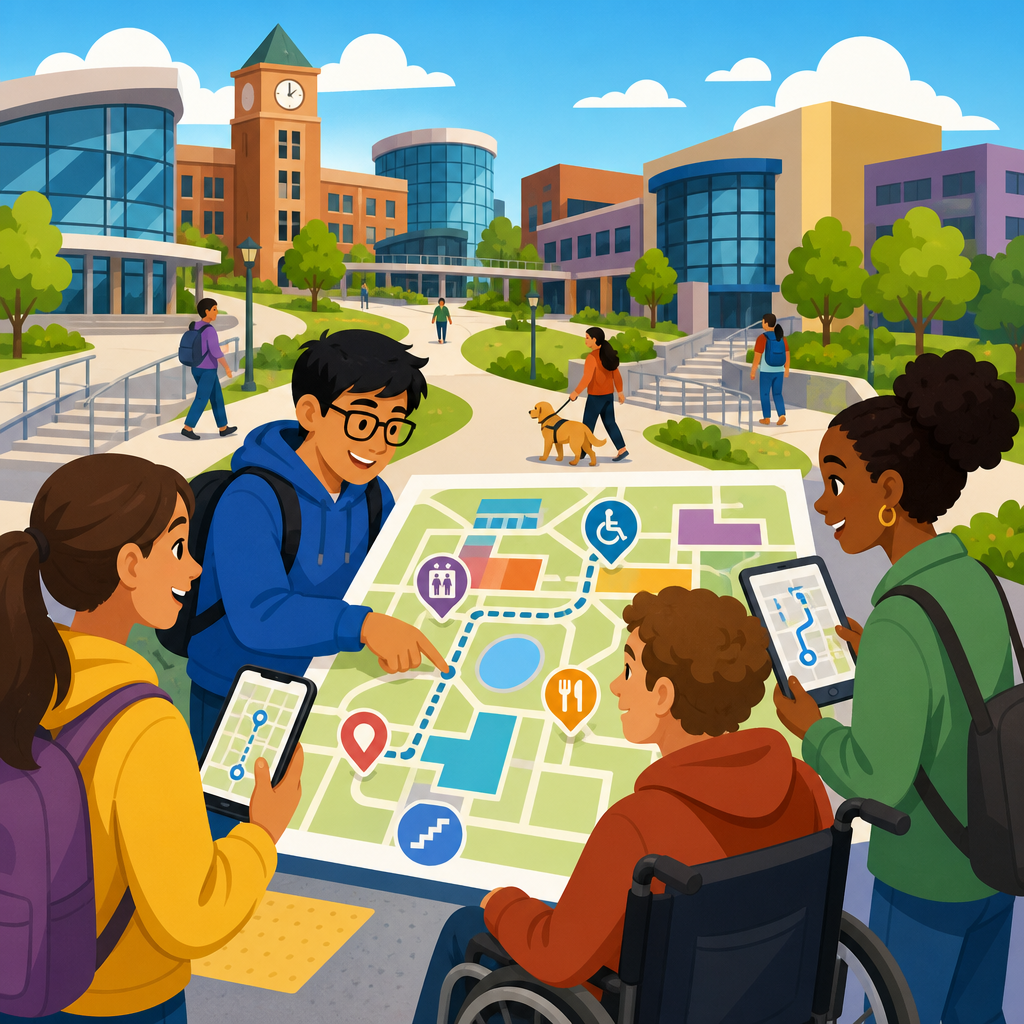
Accessible mapping and wayfinding tools for complex campuses turn a confusing built environment into a navigable, usable place for everyone, including people with visual, cognitive, hearing, and mobility disabilities. In practice, these tools combine digital maps, physical signage, routing logic, location technology, and accessibility data so a student, patient, visitor, or employee can plan a trip, follow it in real time, and recover when conditions change. Complex campuses include universities, hospitals, airports, corporate headquarters, government centers, and mixed-use districts where multiple buildings, entrances, floors, transit links, and temporary barriers create friction. I have worked with campus maps that looked polished on a desktop but failed the moment a wheelchair user needed the nearest automatic door or a blind visitor needed reliable turn-by-turn indoor guidance. That gap matters because navigation is not a convenience feature; it directly affects safety, independence, punctuality, and equal access to services. For organizations investing in advanced technology for accessibility, mapping and wayfinding sit at the center because they connect mobility, information access, building operations, and user trust across the entire environment.
A strong accessible wayfinding system starts with definitions. Accessibility means people with different disabilities can perceive, understand, and use the map and the route guidance. Wayfinding is the process of orienting, deciding, moving, and confirming arrival. Indoor positioning refers to technologies such as Bluetooth Low Energy beacons, Wi-Fi fingerprinting, ultra-wideband, inertial sensors, and computer vision that estimate where a person is inside a building. Digital twins and geographic information systems organize spatial data, while routing engines apply rules such as elevator availability, curb-cut locations, slope limits, and step-free paths. Standards shape the work. The Americans with Disabilities Act and Section 508 affect public-facing digital systems in the United States, while Web Content Accessibility Guidelines set expectations for perceivable, operable, understandable, and robust interfaces. On the physical side, ADA Standards for Accessible Design, tactile signage requirements, and local building codes influence what route options can honestly be presented. The core principle is simple: an accessible campus map must describe the environment as it is actually experienced, not as designers assume it works.
Why complex campuses need accessible wayfinding systems
Large campuses produce unique navigation problems because they are rarely a single building with one front door. A medical campus may include clinics, labs, emergency entrances, parking decks, skybridges, and security checkpoints. A university may add residence halls, lecture theaters, sports venues, libraries, and construction detours that change weekly. Visitors often arrive stressed, unfamiliar with the site, and under time pressure. In hospitals, missed appointments and late arrivals are frequently linked to navigation failure rather than unwillingness to attend. In higher education, poor wayfinding can isolate disabled students from classes, tutoring, or events. For staff, every repeated “how do I get there?” interaction is a hidden operational cost. Accessible mapping reduces these failures by making route information consistent across websites, kiosks, mobile apps, printed materials, and signs.
The accessibility case is also a business and compliance case. An inaccessible map can become a barrier equivalent to a locked door because it prevents people from locating an accessible entrance, restroom, elevator, or service desk. Organizations that modernize wayfinding often see measurable gains: reduced missed appointments, fewer calls to front desks, faster visitor flow, and better satisfaction scores. Airports have used step-free route guidance and sensory-friendly navigation details to improve traveler confidence. Universities increasingly publish accessible campus maps that identify grade changes, automatic doors, all-gender restrooms, lactation rooms, and hearing loop locations. Corporate campuses add desk-booking, shuttle tracking, and visitor management integration so an employee can move from gate to meeting room with one accessible journey. The lesson from these deployments is clear: accessibility features help a broad population, including parents with strollers, travelers with luggage, older adults, temporary injury cases, and first-time visitors.
Core components of an accessible mapping platform
An effective platform has four layers: accurate spatial data, accessible interfaces, reliable positioning, and intelligent routing. Spatial data must include more than room polygons and building names. It should model entrances, elevator banks, stairwells, ramps, path widths, door hardware, floor materials, thresholds, curb ramps, drop-off zones, and points of interest. If a route crosses a parking lot without a protected pedestrian path, the map should represent that risk. If an elevator serves only certain floors after hours, the data model should capture that schedule. This level of detail is what allows route calculations to reflect lived accessibility rather than generic shortest-path logic.
Interfaces must work with screen readers, keyboard navigation, voice control, high contrast settings, magnification, captions, and plain-language instructions. In projects I have reviewed, the most common failure is a beautiful interactive map built on a canvas element with no accessible labels, no list view, and no textual route summary. A compliant and useful system offers multiple representations: map view, step list, landmark list, and estimated time. Positioning can rely on smartphone sensors alone outdoors, but indoor environments need stronger support. BLE beacons are affordable and common, Wi-Fi can work where infrastructure already exists, and ultra-wideband offers high precision at higher cost. Routing logic then applies constraints. A wheelchair route should avoid stairs and narrow turnstiles. A blind-friendly route may prefer consistent corridors, detectable landmarks, and fewer ambiguous intersections. A neurodivergent user may prefer the quietest path, not the shortest. The best systems let users set these preferences directly.
| Component | What it does | Accessibility value | Common tools or methods |
|---|---|---|---|
| Spatial data layer | Stores buildings, paths, entrances, rooms, amenities, barriers, and attributes | Enables accurate accessible route options and amenity discovery | GIS, BIM, CAD conversion, digital twins |
| User interface | Presents maps, directions, search, and route settings | Supports screen readers, keyboard use, contrast, zoom, captions, plain language | Accessible mobile apps, web maps, kiosks |
| Positioning layer | Estimates the user’s indoor or outdoor location | Improves confidence and rerouting for blind and low-vision travelers | GPS, BLE beacons, Wi-Fi, UWB, inertial sensors |
| Routing engine | Calculates paths based on rules and live conditions | Produces step-free, low-stimulus, or landmark-rich routes | Network analysis, accessibility rules, geofencing |
| Operations integration | Feeds closures, outages, and schedules into the map | Keeps routes trustworthy when elevators or entrances change | CMMS, ticketing systems, occupancy and event data |
Designing for different disabilities and real user needs
Accessible campus wayfinding must be multimodal because no single interface serves all users well. For blind and low-vision users, the essentials are screen-reader-friendly search, detailed turn instructions, tactile and audible cues in the environment, and route confirmation at key decision points. Good directions say “proceed 20 feet to the elevator lobby, with the reception desk on your right,” not just “turn left.” Landmarks matter because they match how people build mental maps. Some institutions pair mobile guidance with tactile maps near major entrances, which remain valuable when batteries fail or visitors do not want to install an app.
For Deaf and hard-of-hearing users, accessibility includes visual alerts, captioned help content, clear iconography, and low reliance on spoken-only announcements. For people with mobility disabilities, route quality depends on slope, cross-slope, curb cuts, elevator status, doorway clearance, and seating along long corridors. For users with cognitive disabilities, simplicity is critical. Plain language, reduced clutter, predictable symbols, and fewer decision points lower cognitive load. I have seen route abandonment drop when campuses replaced abstract building codes with familiar names and photos of entrances. Sensory considerations also matter. A user with autism may want to avoid noisy atriums or flashing digital displays, while a person with chronic fatigue may need routes that prioritize rest areas. Personalization is no longer optional. Advanced technology for accessibility works best when it lets users choose preferences without requiring them to justify a disability or expose sensitive medical details.
Advanced technologies shaping accessible campus navigation
The most important shift in recent years is the move from static maps to responsive location services. Indoor positioning has become practical enough for large campuses to deploy at scale, though accuracy still varies by building materials and infrastructure quality. BLE beacon networks are often used because smartphones support them well and installation is manageable. Ultra-wideband can deliver tighter precision for high-stakes settings such as hospitals, where a wrong turn into restricted care areas is more serious than in an academic hall. Computer vision can identify doors, signs, or obstacles through a phone camera, while LiDAR-enabled devices improve spatial awareness for some users. These technologies are strongest when combined rather than treated as standalone solutions.
Artificial intelligence is improving wayfinding in two concrete ways. First, natural language search helps users ask for what they mean: “quiet entrance near cardiology,” “wheelchair path from parking to registrar,” or “restroom with adult changing table.” Second, predictive routing can factor in live conditions such as elevator outages, crowd density, weather, shuttle arrival times, and construction. Hospitals and airports are especially suited to this because operational data changes minute by minute. The caution is that algorithmic confidence must never outrun data quality. If maintenance teams do not update closures quickly, an AI-powered assistant will simply generate inaccessible directions faster. Trust comes from governance: verified data owners, update schedules, test scripts with disabled users, and escalation paths when a route fails.
Implementation strategy, governance, and measurement
Successful deployment starts with a campus accessibility audit and a content inventory, not with app design. Teams should document every building, route segment, entrance, vertical circulation point, and accessible amenity, then validate that data on site. This is where many projects underestimate labor. Floor plans are often outdated, room names differ across departments, and “accessible entrance” labels may ignore intercom reach ranges or heavy manual doors. A cross-functional governance model works best: facilities manages the built environment data, disability services or patient experience teams define user needs, IT manages identity and integration, communications controls naming standards, and procurement sets accessibility requirements in vendor contracts.
Measurement should include both usability and operational outcomes. Standard metrics include task completion rate, time to destination, reroute frequency, missed appointment reduction, support call volume, and user-reported confidence. For digital accessibility, test with screen readers such as NVDA, JAWS, and VoiceOver, and verify keyboard-only workflows. For physical-digital continuity, conduct real walks with wheelchair users, blind users, and people with cognitive disabilities. In my experience, pilot testing one high-friction journey reveals more than reviewing twenty screenshots. For example, tracing the path from an accessible parking bay to a second-floor clinic may expose a broken door operator, unclear elevator naming, poor cellular coverage, and a kiosk mounted too high. Those findings can then feed a broader roadmap. Internal linking from parking, transportation, visitor services, disability resources, and emergency preparedness pages also strengthens adoption because users encounter the map in the context of actual tasks.
How this hub connects the broader accessibility technology stack
Accessible mapping is the hub for advanced technology for accessibility because it unifies many specialized systems into a single user journey. Assistive mobile apps, real-time transit feeds, accessible kiosks, hearing loop locators, smart door controls, occupancy sensors, and digital signage all become more useful when tied to a navigable spatial model. A campus that invests in captioned communications but fails to guide visitors to the correct service window still leaves access incomplete. Likewise, a building with compliant ramps but no discoverable route data creates hidden friction. Wayfinding closes these gaps by translating accessibility features into actionable directions. It also supports emergency planning, since evacuation maps, refuge areas, and backup routes can be adapted for different mobility and sensory needs.
The practical takeaway is to treat accessible wayfinding as infrastructure, not decoration. Build a trustworthy data model. Publish route options that reflect real conditions. Test with disabled users in the field, not just in conference rooms. Connect the map to operations so closures, outages, and events update quickly. When organizations do this well, they improve independence for disabled people and make the entire campus easier to understand for everyone else. As you plan your technology and accessibility roadmap, start by auditing navigation pain points, then prioritize the journeys that matter most: arrival, entry, vertical movement, service access, and exit. That work creates the foundation for every other accessibility technology initiative that follows.
Frequently Asked Questions
What are accessible mapping and wayfinding tools for complex campuses, and why do they matter?
Accessible mapping and wayfinding tools are systems that help people understand, plan, and complete trips across large, complicated environments such as universities, medical centers, corporate campuses, and multi-building public facilities. Instead of relying on a simple static map, these tools bring together digital campus maps, accessible route data, physical signage, real-time directions, and location-aware guidance to support people with different needs and preferences. A well-designed system may show step-free routes, elevator locations, curb ramps, accessible entrances, automatic doors, restrooms, transit stops, drop-off points, and temporary disruptions such as construction or closures.
They matter because complex campuses are often difficult to navigate even for frequent users, and the challenge increases significantly for people with visual, cognitive, hearing, and mobility disabilities. A route that looks short on a map may include stairs, confusing intersections, poor signage, or inaccessible doorways. Accessible wayfinding reduces that uncertainty by giving people clearer information before and during travel. It helps students get to class independently, patients arrive at the right clinic with less stress, visitors move through unfamiliar buildings more confidently, and employees navigate daily tasks more efficiently. In short, these tools do more than improve convenience; they support equity, independence, safety, and meaningful access to the campus experience.
What features should an accessible campus wayfinding solution include?
An effective accessible wayfinding solution should support the full journey, from trip planning to arrival and rerouting. At a minimum, it should provide detailed digital maps, searchable destinations, and route options tailored to accessibility needs. That means users should be able to identify step-free paths, elevators, ramps, accessible parking, entrances with automatic doors, rest areas, and other features that affect whether a route is usable in practice. The routing engine should also account for real campus conditions, including grade changes, crosswalks, surface types, indoor-outdoor transitions, and spaces where navigation is commonly confusing.
Strong solutions also include multimodal communication. Visual turn-by-turn directions should be paired with text instructions, screen-reader compatibility, high-contrast interfaces, and support for large text or zoom. For users who are blind or have low vision, landmark-based directions and audio guidance can be especially valuable. For users with cognitive disabilities, plain language, simplified route views, and predictable interface design can reduce overload. For people who are deaf or hard of hearing, visual alerts and clear text-based instructions are important, particularly in environments where public address systems or verbal guidance are commonly used.
Another essential feature is real-time responsiveness. Campuses change constantly due to construction, locked doors, elevator outages, event crowds, and temporary detours. A useful system should surface these changes quickly and reroute people in a way that preserves accessibility, rather than simply sending them to the shortest path. Ideally, the tool should integrate indoor and outdoor navigation so users do not lose guidance when moving from a sidewalk into a lobby, across a tunnel, or through a multi-floor building. When these features work together, the result is a tool that reflects how people actually travel through complex environments, not just how spaces were drawn on a map.
How do accessible wayfinding tools support people with different types of disabilities?
The best accessible mapping and wayfinding tools are designed around the fact that accessibility is not one-size-fits-all. People with mobility disabilities may need routes that avoid stairs, steep slopes, narrow doors, broken sidewalks, or long detours without seating. For these users, detailed route attributes such as path grade, curb ramps, elevator access, and door operation can make the difference between a route that is possible and one that is not. Someone using a wheelchair, scooter, walker, or cane benefits from route information that reflects actual travel conditions rather than general assumptions about accessibility.
People who are blind or have low vision often need precise orientation support and route instructions based on landmarks, consistent terminology, and accessible digital interfaces. Audio guidance, tactile cues in the physical environment, compatibility with screen readers, and indoor positioning support can all improve independence. Instead of vague directions like “go to the building on the left,” a better system might reference door numbers, hallway intersections, reception desks, or major structural features. This level of detail is especially important in large academic or medical environments where many spaces look similar.
Users with cognitive disabilities may benefit from simplified maps, reduced visual clutter, step-by-step directions, recognizable icons, and route choices that emphasize predictability over speed. Some people prefer fewer decision points, clearer landmarks, or the ability to preview a trip before leaving. Meanwhile, users who are deaf or hard of hearing may rely on visual notifications, text-based instructions, and clearly communicated emergency or rerouting information. The key principle is flexibility: accessible wayfinding should let people choose the format, guidance style, and route type that best fits their needs. That user-centered approach creates a more inclusive campus for everyone, including first-time visitors, older adults, and people dealing with temporary injuries or situational limitations.
What makes campus wayfinding especially challenging compared with standard navigation?
Complex campuses present navigation challenges that ordinary mapping tools often do not handle well. Unlike typical street navigation, campus travel frequently involves a mix of outdoor paths, pedestrian-only corridors, parking structures, courtyards, tunnels, elevators, skybridges, and multi-floor buildings. Destinations may not correspond neatly to postal addresses, and many users are not trying to reach a building alone; they need a specific entrance, clinic suite, lecture hall, admissions office, or accessible service point. On a large campus, getting to the wrong side of a building can add significant time and physical effort, especially for someone with limited mobility or a time-sensitive appointment.
Another complication is that campuses are highly dynamic. Construction zones, event traffic, security restrictions, seasonal weather impacts, and facility outages can all change which routes are practical or accessible. Standard consumer navigation tools may show a path across an area that is technically connected on a map but unusable in reality because a door is locked, an elevator is out of service, or a path has no curb cut. Campus environments also tend to have inconsistent signage, confusing naming conventions, and buildings with multiple entrances that vary widely in accessibility.
Indoor navigation adds another layer of complexity. GPS is often unreliable inside buildings, and many destinations require transitions between indoor and outdoor spaces. Hospitals, research centers, and universities may also have decentralized data about accessibility features, making it harder to keep route information current. Because of these factors, campus wayfinding has to be more context-aware, more granular, and more responsive than general navigation. Accessible solutions succeed when they treat the campus as a lived environment with real barriers and real user needs, rather than as a flat set of paths between points.
How can universities and other large campuses implement accessible wayfinding effectively?
Successful implementation starts with good data and a clear accessibility strategy. Campuses need an accurate inventory of buildings, entrances, sidewalks, ramps, elevators, restrooms, parking areas, transit connections, and other route-relevant features. Just as important, they need accessibility attributes tied to those assets, such as slope, door width, automatic door availability, surface condition, curb ramps, and whether an entrance is step-free. Without this level of detail, a mapping platform may look polished but still fail users at critical moments. Many institutions also benefit from documenting temporary conditions, such as closures and repairs, so route guidance remains dependable.
Equally important is involving disabled users throughout planning, testing, and refinement. Accessibility should not be based solely on technical standards or assumptions from project teams. Students, patients, staff, and visitors with lived experience can identify friction points that are otherwise easy to miss, such as unclear landmarks, confusing interfaces, poor signage placement, or routes that are technically compliant but exhausting in practice. Pilot testing with diverse users helps institutions validate whether the system works in real situations, including first-time visits, bad weather, crowded conditions, and unexpected detours.
Implementation also works best when digital and physical wayfinding are treated as one system. Mobile maps and routing tools should align with on-site signage, building directories, naming conventions, and accessible entry information. Staff should know how to direct people using the same terminology shown in the tool. Finally, campuses need governance to keep information current over time. That means assigning responsibility for map updates, construction notices, accessibility audits, and integration with facilities or transportation teams. When institutions approach accessible wayfinding as ongoing infrastructure rather than a one-time technology purchase, they create a more reliable, inclusive navigation experience that supports compliance, improves user satisfaction, and strengthens access across the entire campus.